
File:Ritter Range Pacific Crest Trail.jpg
Size of this preview: 450 × 600 pixels. Other resolutions: 180 × 240 pixels | 360 × 480 pixels | 576 × 768 pixels | 768 × 1,024 pixels | 1,424 × 1,898 pixels.
Original file (1,424 × 1,898 pixels, file size: 2.8 MB, MIME type: image/jpeg)
| This is a file from the Wikimedia Commons. Information from its description page there is shown below. Commons is a freely licensed media file repository. You can help. |
Summary
| Description |
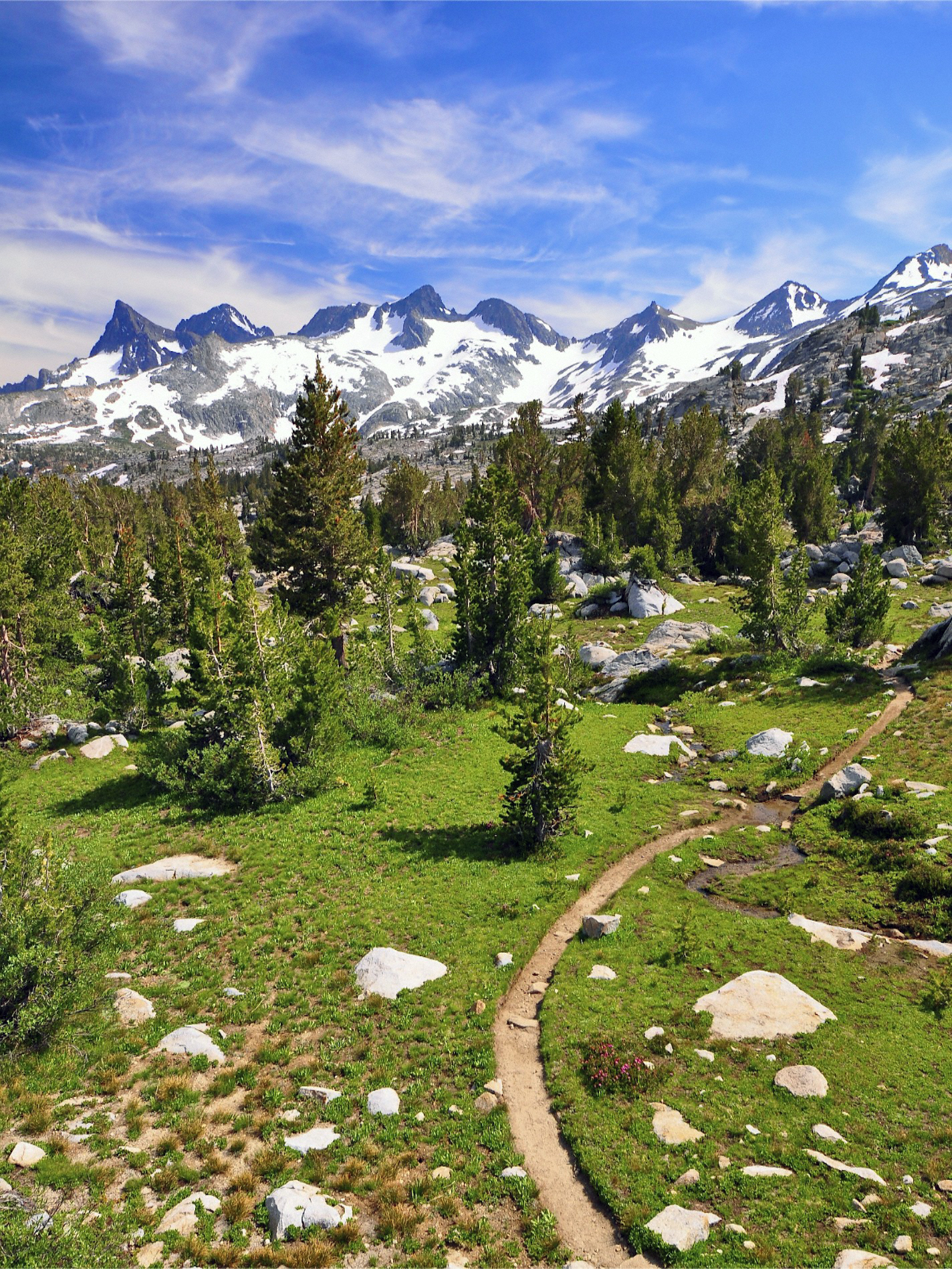
English: The Ritter Range run down the spine of Ansel Adams Wilderness from Yosemite's Mount Lyell to the Minarets west of Mammoth. This photograph was taken between Rush Creek and Donahue Pass. I found a big boulder I could stand on, and shot this vertical - the Pacific Crest Trail meandering through the scene. |
| Date | Taken on 12 August 2011, 15:33 |
| Source | Ritter Range, Ansel Adams Wilderness |
| Author | Steve Dunleavy from Lake Tahoe, NV, United States |
Licensing
This file is licensed under the Creative Commons Attribution 2.0 Generic license.
- You are free:
- to share – to copy, distribute and transmit the work
- to remix – to adapt the work
- Under the following conditions:
- attribution – You must give appropriate credit, provide a link to the license, and indicate if changes were made. You may do so in any reasonable manner, but not in any way that suggests the licensor endorses you or your use.
| This image, originally posted to Flickr, was reviewed on 21 October 2012 by the administrator or reviewer File Upload Bot (Magnus Manske), who confirmed that it was available on Flickr under the stated license on that date. |
File history
Click on a date/time to view the file as it appeared at that time.
| Date/Time | Thumbnail | Dimensions | User | Comment | |
|---|---|---|---|---|---|
| current | 23:45, 21 October 2012 | | 1,424 × 1,898 (2.8 MB) | File Upload Bot (Magnus Manske) | Transferred from Flickr by User:Hike395 using flickr2commons |
File usage
The following pages on the English Wikipedia use this file (pages on other projects are not listed):
- American Discovery Trail
- Backbone Trail
- Barbary Coast Trail
- Bay Area Ridge Trail
- Bigfoot Trail
- Brad Freeman Trail
- Cactus to Clouds Trail
- California Coastal Trail
- Contra Costa Canal
- Coyote Creek Trail
- Four Mile Trail
- Gabrielino Trail
- Great Western Loop
- Hammond Trail
- Hetch Hetchy to Lake Vernon Trail
- High Sierra Trail
- Independence Trail
- Iron Horse Regional Trail
- Jedediah Smith Memorial Trail
- Joe Rodota Trail
- John Muir Trail
- John W. Christian Greenbelt
- Juan Bautista de Anza National Historic Trail
- Lafayette-Moraga Regional Trail
- Long Meadow Grove
- Los Gatos Creek Trail
- Lost Palms Oasis Trail
- Lower Sagehen Creek Hiking Trail
- MacKerricher State Park
- Mist Trail
- Mount Whitney Trail
- Mount Wilson Toll Road
- Nobles Emigrant Trail
- Ohlone Greenway
- Pacific Crest Trail
- Philosopher's Way, San Francisco
- Pine Ridge Trail
- Pinnacle and Shorttail Gulch Coastal Access Trails
- Richmond Greenway
- Sam Merrill Trail
- San Francisco Bay Trail
- Santa Clara River Trail
- Santa Cruz Trail
- Santa Rosa Creek
- Sawyer Camp Trail
- Sierra High Route
- Silver Knapsack Trail
- Silver Moccasin Trail
- Skyline-to-the-Sea Trail
- Sonoma Coast State Park
- Spur Trail
- Tahoe Rim Trail
- Tahoe–Pyramid Trail
- Tahoe–Yosemite Trail
- Theodore Solomons Trail
- Three Creeks Trail
- Trans-Catalina Trail
- Ventura River Parkway Trail
- Windy Gap Trail (Angeles National Forest)
- User:OberMegaTrans/Pacific Crest Trail
- Template:California hiking trails
Global file usage
The following other wikis use this file:
- Usage on ar.wikipedia.org
- Usage on bg.wikipedia.org
- Usage on cs.wikipedia.org
- Usage on de.wikipedia.org
- Usage on en.wikivoyage.org
- Usage on es.wikipedia.org
- Usage on eu.wikipedia.org
- Usage on fa.wikipedia.org
- Usage on fi.wikipedia.org
- Usage on he.wikipedia.org
- Usage on it.wikipedia.org
- Usage on no.wikipedia.org
- Usage on ru.wikipedia.org
- Usage on tr.wikipedia.org
- Usage on www.wikidata.org
- Usage on zh-two.iwiki.icu