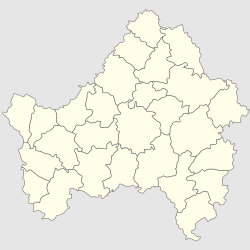
Klimovo, Bryansk Oblast
Klimovo
Климово | |
|---|---|
| Coordinates: 52°23′N 32°11′E / 52.383°N 32.183°E | |
| Country | Russia |
| Federal subject | Bryansk Oblast |
| Founded | 1708 |
| Town status since | 1938 |
| Elevation | 160 m (520 ft) |
| Population | |
| • Estimate (2018)[1] | 13,061 |
| • Density | 800/km2 (2,000/sq mi) |
| • Capital of | Klimovsky District |
| Time zone | UTC+3 (MSK |
| Postal code(s)[3] | |
| Dialing code(s) | +7 48347 |
| OKTMO ID | 15628151051 |
| Website | klimadm |
Klimovo (Russian: Кли́мово) is an urban-type settlement in Bryansk Oblast, Russia. Population: 13,554 (2021 Census);[4] 13,892 (2010 Census);[5] 14,776 (2002 Census);[6] 14,637 (1989 Census).[7]
The Old Believer church of Saint Demetrius is a sightseeing point.
History[edit]
It was founded in 1708 by Klim Ermolaevich. It was granted town status in 1938. From 1929 Klimovo is a center of Klimovo district.
During World War II, Klimovo was occupied by the German Army from 25 August 1941 to 24 September 1943. The 1939 census recorded that the Jewish population was 224, or 4 percent of the total. During that time a half of Jewish population fled on the East and men joined the army.
On 29 August 1941, 27 Jews accused of being Bolshevist agents were shot. In October, 1941, a ghetto was created and it was liquidated in March, 1942. During the liquidation about 280 Jews were executed by German security forces. They were shot in a peat quarry, about 1 kilometre (0.62 mi) away from Klimovo. Afterwards isolated shootings took place until the German withdrawal in September, 1943.[8]
On 14 April 2022, Russia claimed that Ukrainian attack helicopters attacked the settlement. Russian authorities said helicopters bombarded residential areas six times, damaging six buildings.[9] The local hospital said seven people were injured,[10] two of them seriously.[9] Ukrainian authorities rejected Russian claims and stated that Russia had staged "terror attacks" on its own population to whip up "anti-Ukrainian hysteria".[11] The incident happened amid an invasion of Ukraine by the Russian Federation.
Ecological problems[edit]
As a result of the Chernobyl disaster on April 26, 1986, part of the territory of Bryansk Oblast has been contaminated with radionuclides (mainly Gordeyevsky, Klimovsky, Klintsovsky, Krasnogorsky, Surazhsky, and Novozybkovsky Districts). In 1999, some 226,000 people lived in areas with the contamination level above 5 Curie/km2, representing approximately 16% of the oblast's population.
References[edit]
Notes[edit]
- ^ "26. Численность постоянного населения Российской Федерации по муниципальным образованиям на 1 января 2018 года". Federal State Statistics Service. Retrieved 23 January 2019.
- ^ "Об исчислении времени". Официальный интернет-портал правовой информации (in Russian). 3 June 2011. Retrieved 19 January 2019.
- ^ Почта России. Информационно-вычислительный центр ОАСУ РПО. (Russian Post). Поиск объектов почтовой связи (Postal Objects Search) (in Russian)
- ^ Russian Federal State Statistics Service. Всероссийская перепись населения 2020 года. Том 1 [2020 All-Russian Population Census, vol. 1] (XLS) (in Russian). Federal State Statistics Service.
- ^ Russian Federal State Statistics Service (2011). Всероссийская перепись населения 2010 года. Том 1 [2010 All-Russian Population Census, vol. 1]. Всероссийская перепись населения 2010 года [2010 All-Russia Population Census] (in Russian). Federal State Statistics Service.
- ^ Russian Federal State Statistics Service (21 May 2004). Численность населения России, субъектов Российской Федерации в составе федеральных округов, районов, городских поселений, сельских населённых пунктов – районных центров и сельских населённых пунктов с населением 3 тысячи и более человек [Population of Russia, Its Federal Districts, Federal Subjects, Districts, Urban Localities, Rural Localities—Administrative Centers, and Rural Localities with Population of Over 3,000] (XLS). Всероссийская перепись населения 2002 года [All-Russia Population Census of 2002] (in Russian).
- ^ Всесоюзная перепись населения 1989 г. Численность наличного населения союзных и автономных республик, автономных областей и округов, краёв, областей, районов, городских поселений и сёл-райцентров [All Union Population Census of 1989: Present Population of Union and Autonomous Republics, Autonomous Oblasts and Okrugs, Krais, Oblasts, Districts, Urban Settlements, and Villages Serving as District Administrative Centers]. Всесоюзная перепись населения 1989 года [All-Union Population Census of 1989] (in Russian). Институт демографии Национального исследовательского университета: Высшая школа экономики [Institute of Demography at the National Research University: Higher School of Economics]. 1989 – via Demoscope Weekly.
- ^ "Yahad - in Unum".
- ^ a b "Russia says Ukraine helicopters strike homes in cross-border attack". Reuters. 2022-04-14. Retrieved 2022-04-14.
- ^ "Russia Accuses Ukraine Of Shelling Its Bryansk Region". RadioFreeEurope/RadioLiberty. Retrieved 2022-04-14.
- ^ "Ukraine rejects Russian claim of attacks on border region".


