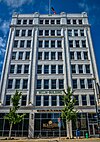
Packers Heritage Trail

Coordinates: 44°30′55″N 88°0′55″W / 44.51528°N 88.01528°W / 44.51528; -88.01528
From Wikipedia, the free encyclopedia
Packers Heritage Trail
A logo that says "Packers Heritage Trail"; the "Packers" is on a small flag and a football is located below the text
LocationGreen Bay, Wisconsin
EstablishedNovember 2011
UseWalking/Biking
WebsiteOfficial website

The Packers Heritage Trail is a self-guided walking tour that traverses locations relating to the history of the Green Bay Packers. 22 of the sites have bronze commemorative plaques.[1] 21 sites are located within a two-mile radius of downtown Green Bay. The Trail was developed by sportswriter Cliff Christl.[2][3]

Historic sites[edit]

# Image Site Address Trail portion Plaque location Coordinates Ref
Packers Heritage Plaza
Washington St. & Cherry St. City Walk
44°30′55.3″N 88°0′54.7″W / 44.515361°N 88.015194°W / 44.515361; -88.015194 (Packers Heritage Plaza) [4]
1
210 Museum Place Near parking lot 44°31′4.8″N 88°1′5.3″W / 44.518000°N 88.018139°W / 44.518000; -88.018139 (Packers Neville Museum)
2
Downtown Green Bay
325 N. Washington St. In back along CityDeck 44°31′1.9″N 88°0′54.4″W / 44.517194°N 88.015111°W / 44.517194; -88.015111 (Downtown Green Bay)
3
Birthplace of the Packers
200 N. Adams St. On Cherry St. 44°30′52.8″N 88°0′48.2″W / 44.514667°N 88.013389°W / 44.514667; -88.013389 (Birthplace of the Packes)
4
304 N. Adams St. On Pine St. 44°30′56.8″N 88°0′47.2″W / 44.515778°N 88.013111°W / 44.515778; -88.013111 (Hotel Northland)
5
Curly Lambeau's Office, Northern Building
305 E. Walnut St. On Adams St. 44°30′50″N 88°0′52.3″W / 44.51389°N 88.014528°W / 44.51389; -88.014528 (Curly Lambeau's Office, Northern Building)
6
130 E. Walnut St. On Walnut St. 44°30′51.4″N 88°0′59″W / 44.514278°N 88.01639°W / 44.514278; -88.01639 (Bellin Building)
7
400 S. Washington St. On Washington St. 44°30′38″N 88°1′7.6″W / 44.51056°N 88.018778°W / 44.51056; -88.018778 (Milwaukee Road Depot)
8
Packers Office Building
321 S. Washington St. On Crooks St. 44°30′38.6″N 88°1′6″W / 44.510722°N 88.01833°W / 44.510722; -88.01833 (Packers Office Building)
9
300 Crooks St. On Adams St. 44°30′36″N 88°1′1.7″W / 44.51000°N 88.017139°W / 44.51000; -88.017139 (Elks Club)
10
209 S. Adams St. Corner of Adams St. & Doty St. 44°30′44.8″N 88°0′55.8″W / 44.512444°N 88.015500°W / 44.512444; -88.015500 (St. Willebrord Catholic Church)
11
100 S. Jefferson St. 44°30′44.7″N 88°0′51.1″W / 44.512417°N 88.014194°W / 44.512417; -88.014194 (Brown County Courthouse)
12
Columbus Community Club
115 S. Jefferson St. On Jefferson St. 44°30′46″N 88°0′48.1″W / 44.51278°N 88.013361°W / 44.51278; -88.013361 (Columbus Community Club)
13
435 E. Walnut St. On Walnut St. 44°30′46.9″N 88°0′44.1″W / 44.513028°N 88.012250°W / 44.513028; -88.012250 (Green Bay Press-Gazette)
14
1415 E. Walnut St. On Baird St. 44°30′26.4″N 87°59′40.5″W / 44.507333°N 87.994583°W / 44.507333; -87.994583 (Hagemeister Park)
15
400 S. Washington St. On front gates 44°30′29.1″N 87°59′37.4″W / 44.508083°N 87.993722°W / 44.508083; -87.993722 (City Stadium)
16
Curly Lambeau's Birthplace Home
615 N. Irwin Ave. On Irwin Ave. 44°30′47″N 87°59′39.6″W / 44.51306°N 87.994333°W / 44.51306; -87.994333 (Curly Lambeau's Birthplace Home)
17
200 Dousman St. Near entrance 44°31′9.7″N 88°1′5.5″W / 44.519361°N 88.018194°W / 44.519361; -88.018194 (Chicago and North Western Depot)
18
Packers Practice Fields
N. Baird St. Packing Plant Spur North of City Stadium 44°30′33.8″N 87°59′35″W / 44.509389°N 87.99306°W / 44.509389; -87.99306 (Packers Practice Fields)
19
1560 Main St. Near entrance 44°30′16.9″N 87°59′13.2″W / 44.504694°N 87.987000°W / 44.504694; -87.987000 (Riverside Ballroom)
20
1613 Main St. On Janquet Lumber building 44°30′15.9″N 87°59′3.5″W / 44.504417°N 87.984306°W / 44.504417; -87.984306 (Bellevue Park)
21
Main St. & Elizabeth St. Start of Kress Trail 44°30′19.2″N 87°59′8.2″W / 44.505333°N 87.985611°W / 44.505333; -87.985611 (Indian and Acme Packing Plants)
22
Curly Lambeau's Gravesite
2121 Riverside Dr.[a] Lambeau - Lombardi Spur On Fox River Trail near Allouez Catholic Cemetery[a] 44°29′3.5″N 88°1′52.8″W / 44.484306°N 88.031333°W / 44.484306; -88.031333 (Curly Lambeau's Gravesite)[a]
23
667 Sunset Cir. No plaque 44°27′56.3″N 88°3′0.3″W / 44.465639°N 88.050083°W / 44.465639; -88.050083 (Vince Lombardi's Home)
24
200 N. Broadway St. Corner of Broadway St. & James St. 44°27′0.6″N 88°3′37.1″W / 44.450167°N 88.060306°W / 44.450167; -88.060306 (Union Hotel)
25
505 Third St. On Third St. 44°26′34.9″N 88°4′7.1″W / 44.443028°N 88.068639°W / 44.443028; -88.068639 (St. Norbert College)

Footnotes[edit]

  1. ^ a b c The address provided for Curly Lambeau's Gravesite is for the Allouez Catholic Cemetery, where Lambeau is buried. However, the plaque for the Packers Heritage Trail is located a short distance from the Cemetery along the public-accessible Fox River Trail. The coordinates provided are for the plaque, not the gravesite.

References[edit]

Sources[edit]

  1. ^ "Packers Heritage Trail". Neville Public Museum of Brown County. 2014. Archived from the original on April 14, 2019. Retrieved September 16, 2019.
  2. ^ "Packers Heritage Trail". Green Bay Packers, Inc. Archived from the original on August 28, 2019. Retrieved September 16, 2019.
  3. ^ Ryman, Richard (September 15, 2013). "Heritage Trail Plaza open in downtown Green Bay". Green Bay Press-Gazette. p. A10. Archived from the original on September 16, 2019. Retrieved September 16, 2019.
  4. ^ "Packers Heritage Trail Map". PackersHoFandTours.com. Retrieved April 23, 2024.

Bibliography[edit]

External links[edit]

44°30′55″N 88°0′55″W / 44.51528°N 88.01528°W / 44.51528; -88.01528