
Wind Point, Wisconsin
Wind Point, Wisconsin | |
|---|---|
 Location of Wind Point in Racine County, Wisconsin. | |
| Coordinates: 42°46′57″N 87°46′27″W / 42.78250°N 87.77417°W | |
| Country | |
| State | |
| County | Racine |
| Area | |
| • Total | 1.29 sq mi (3.34 km2) |
| • Land | 1.27 sq mi (3.28 km2) |
| • Water | 0.03 sq mi (0.07 km2) |
| Elevation | 614 ft (187 m) |
| Population (2020) | |
| • Total | 1,651 |
| • Density | 1,338.86/sq mi (517.09/km2) |
| Time zone | UTC-6 (Central (CST)) |
| • Summer (DST) | UTC-5 (CDT) |
| Area code | 262 |
| FIPS code | 55-87700[3] |
| GNIS feature ID | 1576848[2] |
| Website | www |
Wind Point is a village in Racine County, Wisconsin, United States. The population was 1,651 at the 2020 census.
Geography[edit]
Wind Point is located at 42°46′57″N 87°46′27″W / 42.78250°N 87.77417°W (42.782452, -87.774173).[5]
According to the United States Census Bureau, the village has a total area of 1.42 square miles (3.68 km2), of which, 1.25 square miles (3.24 km2) of it is land and 0.17 square miles (0.44 km2) is water.[6]
Demographics[edit]
| Census | Pop. | Note | %± |
|---|---|---|---|
| 1960 | 463 | — | |
| 1970 | 1,251 | 170.2% | |
| 1980 | 1,695 | 35.5% | |
| 1990 | 1,941 | 14.5% | |
| 2000 | 1,853 | −4.5% | |
| 2010 | 1,723 | −7.0% | |
| 2020 | 1,651 | −4.2% | |
| U.S. Decennial Census[7] | |||
2010 census[edit]
As of the census[8] of 2010, there were 1,723 people, 731 households, and 551 families living in the village. The population density was 1,378.4 inhabitants per square mile (532.2/km2). There were 776 housing units at an average density of 620.8 per square mile (239.7/km2). The racial makeup of the village was 95.7% European American, 0.8% African American, 0.1% Native American, 2.3% Asian, 0.5% from other races, and 0.7% from two or more races. Hispanic or Latino of any race were 2.3% of the population.
There were 731 households, of which 23.8% had children under the age of 18 living with them, 70.2% were married couples living together, 3.7% had a female householder with no husband present, 1.5% had a male householder with no wife present, and 24.6% were non-families. 21.8% of all households were made up of individuals, and 12.1% had someone living alone who was 65 years of age or older. The average household size was 2.36 and the average family size was 2.75.
The median age in the village was 52.4 years. 19% of residents were under the age of 18; 4.2% were between the ages of 18 and 24; 12.9% were from 25 to 44; 40.4% were from 45 to 64; and 23.3% were 65 years of age or older. The gender makeup of the village was 48.1% male and 51.9% female.
2000 census[edit]
As of the census[3] of 2000, there were 1,853 people, 736 households, and 587 families living in the village. The population density was 1,513.5 people per square mile (586.4/km2). There were 757 housing units at an average density of 618.3 per square mile (239.6/km2). The racial makeup of the village was 94.7% European American, 0.3% African American, 0.2% Native American, 3.0% Asian, 0.1% from other races, and 1.7% from two or more races. Hispanic or Latino of any race were 1.3% of the population.
There were 736 households, out of which 29.5% had children under the age of 18 living with them, 75.3% were married couples living together, 3.8% had a female householder with no husband present, and 20.2% were non-families. 17.8% of all households were made up of individuals, and 9.4% had someone living alone who was 65 years of age or older. The average household size was 2.52 and the average family size was 2.86.
In the village, the population was spread out, with 23.5% under the age of 18, 3.3% from 18 to 24, 20.0% from 25 to 44, 37.4% from 45 to 64, and 15.7% who were 65 years of age or older. The median age was 47 years. For every 100 females, there were 96.3 males. For every 100 females age 18 and over, there were 92.5 males.
The median income for a household in the village was $88,521, while the median income for a family is $100,614. Males had a median income of $85,555 versus $49,722 for females. The per capita income for the village was $53,104. About 2.8% of families and 3.9% of the population were below the poverty line, including 3.0% of those under age 18 and 5.7% of those age 65 or over.
Education[edit]
Public schools[edit]
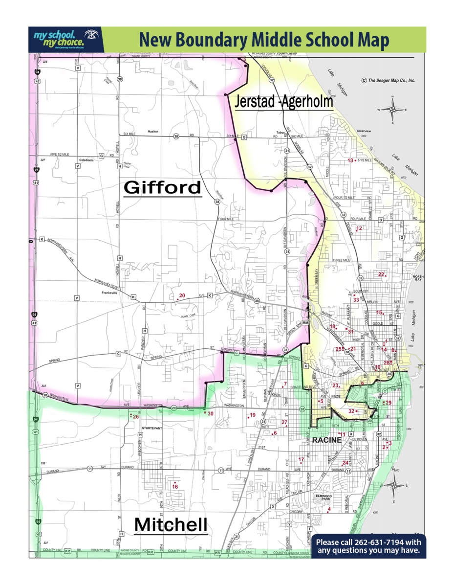
Wind Point is part of the Racine Unified School District.[9] Olympia Brown and North Park elementary schools serve sections of the town,[10] while all residents are zoned to Jerstad-Agerholm K-8 School (formerly Jerstad Middle School) for middle school levels and Horlick High School.[11][12]
The town's only public elementary school, Wind Point Elementary School, which served all of the municipality,[13] opened in 1966.[14] In 2012 it had 237 students, with 50% coming from outside of the school's catchment zone;[15] in the previous year it had the lowest enrollment of any of the elementary schools of Racine USD.[16] Ann Laing, the superintendent of Racine USD, characterized the school as having substandard scores on tests.[15]
Wind Point was closed following the 2012–2013 school year. The school board voted for the closure on a 7 to 1 (Julie McKenna being the sole opposing vote) basis, with one board member, Melvin Hargrove, not appearing. McKenna cited her belief that schools with small student populations would be beneficial.[17] The closure resulted in a $600,000 cost savings for Racine USD.[18] Kathryn Poznanski was the school's final principal.[19]
The Wind Point Elementary building temporarily housed Mitchell Elementary School students in 2014 after a fire damaged that school's permanent campus, but otherwise the school remained unused and the district continued maintaining the building. In 2017 town residents asked the school district to raze the building.[18] In November 2017 the Racine USD school board agreed to have the building given to a limited-liability corporation which would raze the building for fears of vandalism and of perceived poor maintenance.[20] The fixtures and other items in the building were sold in February 2018.[21] Demolition began in April 2018,[22] with housing slated to appear on the former school property.[23]
Private schools[edit]
A private non-parochial school, The Prairie School, serves students in preschool through 12th grade.
Notable buildings[edit]
- The Wind Point Lighthouse is located within the village.
- Frank Lloyd Wright's Wingspread (also known as the Herbert F. Johnson House) is located within the village.
References[edit]
- ^ "2019 U.S. Gazetteer Files". United States Census Bureau. Retrieved August 7, 2020.
- ^ a b "US Board on Geographic Names". United States Geological Survey. October 25, 2007. Retrieved January 31, 2008.
- ^ a b "U.S. Census website". United States Census Bureau. Retrieved January 31, 2008.
- ^ "Population and Housing Unit Estimates". United States Census Bureau. May 24, 2020. Retrieved May 27, 2020.
- ^ "US Gazetteer files: 2010, 2000, and 1990". United States Census Bureau. February 12, 2011. Retrieved April 23, 2011.
- ^ "US Gazetteer files 2010". United States Census Bureau. Retrieved November 18, 2012.
- ^ "Census of Population and Housing". Census.gov. Retrieved June 4, 2015.
- ^ "U.S. Census website". United States Census Bureau. Retrieved November 18, 2012.
- ^ "Village Map". Town of Wind Point. Retrieved July 2, 2019.} or "2010 CENSUS - CENSUS BLOCK MAP: Wind Point village, WI" (PDF). U.S. Census Bureau. Retrieved July 2, 2019. - Compare this map to the school district attendance boundary maps.
- ^ "Elementary School Boundaries" (PDF). Racine Unified School District. Retrieved July 2, 2019. // also: "GRADES K - 5 BOUNDARY AREA MAP" (PDF). Racine Unified School District. Retrieved July 2, 2019.
- ^ "Grades 6-8 Boundary Areas Map" (PDF). Racine Unified School District. Retrieved July 2, 2019. // See also: "Middle School Boundaries" (PDF). Racine Unified School District. Retrieved July 2, 2019. and "New Boundary Middle School Map". Racine Unified School District. Retrieved July 2, 2019.
- ^ "High School Boundaries" (PDF). Racine Unified School District. Retrieved July 2, 2019. // also: "High School Boundary Areas Map" (PDF). Racine Unified School District. Retrieved July 2, 2019.
- ^ "BoundaryMaps.pdf" (PDF). Racine Unified School District. April 7, 2012. Archived from the original (PDF) on April 7, 2012. Retrieved July 7, 2019.
- ^ Roberts, B. Lee (February 18, 2018). "Memories for sale at Wind Point Elementary". The Journal Times. Retrieved July 3, 2019.
Some of Wind Point Elementary's earliest students — who attended from 1966 to 1973[...]
- ^ a b Fiori, Lindsay (December 3, 2012). "Unified targets Wind Point Elementary School". The Journal Times. Retrieved July 3, 2019.}
- ^ Fiori, Lindsay (December 21, 2011). "Redistricting, closing Wind Point discussed by Unified again". The Journal Times. Retrieved July 3, 2019.
- ^ Fiori, Lindsay (December 17, 2012). "Wind Point Elementary School closing". The Journal Times. Retrieved July 2, 2019.
- ^ a b Sadowski, Jonothon (June 5, 2017). "Wind Point pressures Unified to demolish empty school". The Journal Times. Retrieved July 3, 2019.
- ^ Fiori, Lindsay (June 11, 2013). "At Wind Point, truly the last day of school". Racine Journal Times. Retrieved July 3, 2019.
- ^ Spoto, Cara (November 21, 2017). "Wind Point School transfer approved". The Journal Times. Retrieved July 3, 2019.
- ^ Mauk, Alyssa (December 15, 2018). "Wind Point School contents to be sold in Sunday sale". The Journal Times. Retrieved July 3, 2019.
- ^ Rogan, Adam (November 21, 2017). "Wind Point Elementary demolition". The Journal Times. Retrieved July 3, 2019.
- ^ Spoto, Cara (November 18, 2017). "New residential development proposed for Wind Point School property". The Journal Times. Retrieved July 3, 2019.
External links[edit]
Municipalities and communities of Racine County, Wisconsin, United States | ||
|---|---|---|
| Cities |  | |
| Villages | ||
| Towns | ||
| CDPs | ||
| Other communities | ||
| Former communities | ||
| Footnotes | ‡This populated place also has portions in an adjacent county or counties | |
| International | |
|---|---|
| National | |