
List of Category 5 Pacific hurricanes

Category 5 hurricanes are tropical cyclones that reach Category 5 intensity on the Saffir–Simpson hurricane scale. They are by definition the strongest hurricanes that can form on planet Earth. Hurricanes of this intensity are infrequent in the northeastern Pacific Ocean; only 20 have formed since 1959, and they generally develop in clusters during the same year. Landfalls by such storms are rare due to the generally westward path of tropical cyclones in the Northern Hemisphere. The term "hurricane" is used for tropical cyclones in the Pacific Ocean, north of the equator and east of the International Date Line. A Category 5 Pacific hurricane is therefore a tropical cyclone in the north Pacific Ocean that reached Category 5 intensity east of the International Date Line. Identical phenomena in the north Pacific Ocean west of the dateline are called "typhoons" or "super typhoons". Category 5 super typhoons generally happen several times per season, so cyclones of that intensity are not exceptional for that region. This difference in terminology therefore excludes storms such as Typhoon Paka and Typhoon Oliwa of 1997, and Typhoon Genevieve of 2014, which formed east of the dateline but did not reach Category 5 intensity until after crossing the dateline.
Climatology and statistics[edit]
The majority of tropical cyclones form and organize in areas of warm sea surface temperatures, usually of at least 26.5 °C (79.7 °F) and low vertical wind shear; however, there are outliers to this general rule, such as storms that manage to intensify despite high amounts of vertical wind shear. When a pre-existing tropical disturbance – usually a tropical wave or a disturbance originating in the Intertropical Convergence Zone – enters an area where the aforementioned conditions are present, the disturbance can develop into a tropical cyclone, provided it is far enough from the equator to experience a sufficiently strong Coriolis force, which causes the counterclockwise rotation of hurricanes in the Northern Hemisphere.[1]
Between the months of December and April, sea surface temperatures in the tropics, where most Northeast Pacific tropical cyclones develop, are usually too low to support significant development. Also, the presence of a semi-permanent high-pressure area known as the North Pacific High in the eastern Pacific greatly reduces tropical cyclone development in the winter months, as the North Pacific High results in vertical wind shear that causes environmental conditions to be unconducive to tropical cyclone formation. Another factor preventing tropical cyclones from forming during the winter is the presence of a semi-permanent low-pressure area called the Aleutian Low between January and April. Its effects in the central Pacific near the 160th meridian west cause tropical waves that form in the area to move northward into the Gulf of Alaska. As the disturbances travel northward, they dissipate or transition into an extratropical cyclone. The Aleutian Low's retreat in late-April allows the warmth of the Pacific High to meander in, bringing its powerful clockwise wind circulation with it. During the month of May, the Intertropical Convergence Zone migrates southward while vertical shear over the tropics decreases. As a result, the earliest tropical waves begin to form,[2] coinciding with the start of the eastern Pacific hurricane season on May 15.[3] During summer and early autumn, sea surface temperatures rise further, reaching 29 °C (84 °F) in July and August, well above the 26.5 °C (79.7 °F) threshold for the formation and intensification of tropical cyclones. This allows for tropical cyclones developing during that time to strengthen significantly, perhaps even rapidly.[2]
The El Niño–Southern Oscillation also influences the frequency and intensity of hurricanes in the Northeast Pacific basin. During El Niño events, sea surface temperatures increase in the Northeast Pacific and vertical wind shear decreases. Because of this, an increase in tropical cyclone activity occurs; the opposite happens in the Atlantic basin during El Niño, where increased wind shear creates an unfavorable environment for tropical cyclone formation.[4] Contrary to El Niño, La Niña events increase wind shear and decrease sea surface temperatures over the eastern Pacific, while reducing wind shear and increasing sea surface temperatures over the Atlantic.[2]
A Category 5 hurricane is defined as having sustained windspeeds of at least 157 mph (253 km/h) over a one-minute period 10 m (32 ft 10 in) above the ground.[5][6] As a tropical cyclone is moving, its wind field is asymmetric. In the northern hemisphere, the strongest winds are on the right side of the storm (relative to the direction of motion). The highest winds given in advisories are those from the right side.[7]
Since the 1959 season, only 20 hurricanes are known to have reached Category 5 intensity. There are no known Category 5 storms occurring before 1959. It is possible that some earlier storms reached Category 5 over open waters, but they were never recognized because they never affected land and remained at sea.[8]
Category 5 Pacific hurricanes[edit]


This lists all of the Category 5 hurricanes in the order in which they formed according to the central and eastern Pacific HURDAT database, which dates back to 1949. Before the advent of reliable geostationary satellite coverage in 1966, the number of eastern Pacific tropical cyclones was significantly underestimated.[9] It is therefore very possible that there are additional Category 5 hurricanes other than those listed, but they were not reported and therefore not recognized. However, the lack of Pacific Category 5 hurricanes during the late 1970s, 1980s, and early 1990s is considered certain.[8]
The minimum central pressure of these storms is, for the most part, estimated from satellite imagery, typically by using the Dvorak technique to estimate maximum sustained winds and then applying a pressure wind relationship. The reason for estimating the pressure (in lieu of direct measurements) is that most of these storms did not threaten land.[10] In the case of Kenna,[11] Ava,[12] Patricia, and Lane, the central pressure was measured by hurricane hunter aircraft flying into the storm; Kenna, Patricia, and Lane were threatening land, and while Hurricane Ava never threatened land, it too was flown into by hurricane hunters to test equipment and conduct research.[12] Because of the estimation of central pressures, it is possible that other storms more intense than those listed here have formed.[13]
Older storms have incomplete pressure records, since there were no satellite-based estimates; the only observations were taken by ships, land-based observations, or reconnaissance aircraft when available. Ava's minimum known pressure was measured when it was a Category 4 hurricane, for example.[8] John and Gilma have incomplete pressures because the Central Pacific Hurricane Center, in general, did not publish pressure on systems in the central Pacific (140°W to the dateline) at the time.[14] This list is not identical to the list of most intense Pacific hurricanes; for example, 2014's Hurricane Odile, the most intense known Category 4 Pacific hurricane that did not reach Category 5, had a lowest pressure of 918 mbar (27.1 inHg), lower than that of some Category 5 hurricanes, such as Guillermo.[8]
Hurricanes have reached Category 5 intensity during each month from June to October. The earliest to do so was 1973's Hurricane Ava, on June 7. The latest to intensify to Category 5 was 2023's Hurricane Otis on October 25. Hurricanes Ava, Gilma, Ioke, Linda, and Patricia are the most intense storms to form in their respective months. There have been no May, November, or off-season Category 5 hurricanes.[8]
Two Pacific hurricanes are known to have reached Category 5 intensity multiple times: Emilia and Ioke. Both did it twice, and Ioke reached Category 5 status a third time as a typhoon while in the western Pacific.[8] Hurricanes Ioke, John, and Linda are tied for the longest-lasting Category 5 hurricane recorded, spending 42 hours at that strength, but as Ioke's time at Category 5 intensity was in two separate time intervals,[15] John and Linda had the longest time spent consecutively at that intensity.[8]


| Storm name |
Season | Dates while at Category 5 |
Time at Category 5 (hours) |
Peak one-minute sustained winds |
Pressure | ||||
|---|---|---|---|---|---|---|---|---|---|
| mph | km/h | hPa | inHg | ||||||
| Patsy | 1959 | September 6 | 6 | 175 | 280 | 930 | 27.46 | ||
| Ava | 1973 | June 7 | 24 | 160 | 260 | 915 | 27.02 | ||
| Emilia | 1994 | July 19–21† | 18 | 160 | 260 | 926 | 27.34 | ||
| Gilma | 1994 | July 24–25 | 18 | 160 | 260 | 920 | 27.17 | ||
| John | 1994 | August 22–24 | 42 | 175 | 280 | 929 | 27.43 | ||
| Guillermo | 1997 | August 4–5 | 24 | 160 | 260 | 919 | 27.14 | ||
| Linda | 1997 | September 12–14 | 42 | 185 | 295 | 902 | 26.64 | ||
| Elida | 2002 | July 25 | 6 | 160 | 260 | 921 | 27.20 | ||
| Hernan | 2002 | September 1 | 12 | 160 | 260 | 921 | 27.20 | ||
| Kenna | 2002 | October 24 | 18 | 165 | 270 | 913 | 26.96 | ||
| Ioke | 2006 | August 24–26‡ | 42 | 160 | 260 | 915 | 27.02 | ||
| Rick | 2009 | October 18 | 24 | 180 | 285 | 906 | 26.75 | ||
| Celia | 2010 | June 25 | 12 | 160 | 260 | 921 | 27.20 | ||
| Marie | 2014 | August 24 | 6 | 160 | 260 | 918 | 27.11 | ||
| Patricia | 2015 | October 22–23 | 23 | 215 | 345 | 872 | 25.75 | ||
| Lane | 2018 | August 22 | 12 | 160 | 260 | 926 | 27.34 | ||
| Walaka | 2018 | October 1–2 | 12 | 160 | 260 | 921 | 27.20 | ||
| Willa | 2018 | October 22 | 6 | 160 | 260 | 925 | 27.32 | ||
| Jova | 2023 | September 7 | 12 | 160 | 260 | 926 | 27.34 | ||
| Otis | 2023 | October 25 | 9 | 165 | 270 | 922 | 27.23 | ||
| † For its first time at Category 5, Emilia was at that intensity for 6 hours; the second time was for 12 for a total of 18 hours.[16] ‡ For its first time at Category 5, Ioke was at that intensity for 18 hours; the second time was 24 additional hours east of the dateline, giving a total of 42 hours.[8] Ioke did not lose Category 5 status on August 26, but it moved into the Western North Pacific, and thus was no longer considered a hurricane, but rather a typhoon. | |||||||||
Landfalls[edit]

Of all of the Category 5 Pacific hurricanes, only five made landfall at any intensity, all of which occurred during the late-season month of October, and all of which impacted Mexico. Only Hurricane Otis of 2023 was a Category 5 hurricane at landfall. Originally, a hurricane in 1959 was thought to have struck Manzanillo at Category 5 intensity, but a reanalysis in 2016 determined that the storm had peaked as a Category 4 hurricane, and made landfall with the same sustained wind speed as Kenna.[17] Likewise, Patricia was originally determined to have made landfall as a Category 5 hurricane, but was downgraded to a Category 4 hurricane at landfall in post-season reanalysis.[18] This list is not identical to the list of strongest landfalling Pacific hurricanes, as 1976's Hurricane Madeline and 1992's Hurricane Iniki both did not reach Category 5 strength, but made landfall as stronger Category 4 storms than Kenna.[11]
In addition to these five systems, hurricanes John, Linda, Ioke, Lane, and Walaka all threatened land at some point during their existence. John, Ioke and Walaka had minimal impacts on Johnston Atoll, John caused heavy surf in Hawaii, and Walaka passed close to East Island in the French Frigate Shoals.[16] Linda was briefly forecast to approach southern California, and it passed close to Socorro Island near peak intensity.[15][19][20] Out of the five aforementioned hurricanes, Lane had the most significant impact on land, threatening Hawaii as a major hurricane, and dropping more than 40 in (1,000 mm) of rain across many areas.[21]
The reason for the lack of landfalls is that tropical cyclones in the northern hemisphere usually travel to the west[22] due to easterly trade winds. This means Pacific hurricanes generally move westward out into the open Pacific Ocean. Only rarely do tropical cyclones forming during the peak months of the season make landfall. Closer to the end of the season, the subtropical ridge steers some storms northwards or northeastwards. Storms influenced by this ridge may bring impacts to the western coasts of Mexico and occasionally even Central America. In the central Pacific basin, the North Pacific High keeps tropical cyclones away from the Hawaiian Islands by forcing them southwards.[2] Combined with cooler waters around the Hawaiian Islands that tend to weaken tropical cyclones that approach them, this makes direct impacts on the Hawaiian Islands by tropical cyclones rare.[23]
The following table lists the landfalling Category 5 Pacific hurricanes by landfall intensity.
| Name | Year | Category 5
|
Category 4
|
Category 3
|
Category 2
|
Category 1
|
Tropical storm
|
Tropical depression
|
Refs |
|---|---|---|---|---|---|---|---|---|---|
| Kenna | 2002 | — | Nayarit | — | — | — | — | — | [11] |
| Rick | 2009 | — | — | — | — | — | Mazatlán | — | [24] |
| Patricia | 2015 | — | Jalisco | — | — | — | — | — | [18] |
| Willa | 2018 | — | — | Sinaloa | — | — | — | — | [25] |
| Otis | 2023 | Acapulco | — | — | — | — | — | — | [26] |
See also[edit]
- List of the most intense tropical cyclones
- List of Category 5 Atlantic hurricanes
- List of Eastern Pacific tropical storms
- List of Category 1 Pacific hurricanes
- List of Category 2 Pacific hurricanes
- List of Category 3 Pacific hurricanes
- List of Category 4 Pacific hurricanes
- List of F5 and EF5 tornadoes
References[edit]
- ^ Landsea, Christopher W (2014). "TCFAQ A15) How do tropical cyclones form?". Atlantic Oceanographic and Meteorological Laboratory. Archived from the original on August 27, 2009. Retrieved August 18, 2018.
- ^ a b c d Longshore, David (1998). Encyclopedia of hurricanes, typhoons, and cyclones (1st ed.). Facts on File, Inc. pp. 333, 334. ISBN 978-0-8160-3398-0. Archived from the original on August 18, 2018. Retrieved August 18, 2018.
- ^ Dorst, Neal (June 2, 2016). "TCFAQ G1) When is hurricane season?". Atlantic Oceanographic and Meteorological Laboratory. Archived from the original on May 6, 2009. Retrieved July 24, 2018.
- ^ Graham, Steve; Riebeek, Holli (November 1, 2006). "Hurricanes: The Greatest Storms on Earth: Feature Articles". Earth Observatory. United States: National Aeronautics and Space Administration. Archived from the original on May 6, 2017. Retrieved July 24, 2018.
- ^ Schott, Timothy; Landsea, Christopher; Hafele, Gene; Lorens, Jeffrey; Taylor, Arthur; Thrum, Harvey; Ward, Bill; Willis, Mark; Zaleski, Walt (January 2, 2019). The Saffir–Simpson Hurricane Wind Scale (PDF) (Report). United States National Hurricane Center. Retrieved June 4, 2019.
- ^ Chris Landsea. "Subject: D4) What does "maximum sustained wind" mean ? How does it relate to gusts in tropical cyclones?". FAQ: Hurricane, Typhoons, and Tropical Cyclones. Atlantic Oceanographic and Meteorological Laboratory Hurricane Research Division. Retrieved 2006-01-04.
- ^ Chris Landsea. "Subject: D4) What does "maximum sustained wind" mean ? How does it relate to gusts in tropical cyclones?". FAQ: Hurricane, Typhoons, and Tropical Cyclones. Atlantic Oceanographic and Meteorological Laboratory Hurricane Research Division. Retrieved 2006-01-04.
- ^ a b c d e f g h i National Hurricane Center; Hurricane Research Division; Central Pacific Hurricane Center (April 4, 2023). "The Northeast and North Central Pacific hurricane database 1949–2022". United States National Oceanic and Atmospheric Administration's National Weather Service. A guide on how to read the database is available here.
 This article incorporates text from this source, which is in the public domain.
- ^ Chris Landsea (2002-06-11). "Subject: E10) What are the average, most, and least tropical cyclones occurring in each basin?". FAQ: Hurricane, Typhoons, and Tropical Cyclones. Atlantic Oceanographic and Meteorological Laboratory Hurricane Research Division. Retrieved 2006-01-04.
- ^ Neal Dorst. "Subject: H2) Who are the "hurricane hunters" and what are they looking for?". FAQ: Hurricane, Typhoons, and Tropical Cyclones. Atlantic Oceanographic and Meteorological Laboratory Hurricane Research Division. Retrieved 2006-01-04.
- ^ a b c James Franklin (2002-12-26). "Tropical Cyclone Report Hurricane Kenna". National Hurricane Center. Archived from the original on 2014-07-16. Retrieved 2008-09-14.
- ^ a b F.J. Hoelzl (1973-06-06). "wea01151, NOAA's National Weather Service (NWS) Collection". NOAA Photo Library. National Oceanic and Atmospheric Administration. Retrieved 2008-09-14.
- ^ Max Mayfield (1997-10-02). "Preliminary Report Hurricane Guillermo". National Hurricane Center. Retrieved 2008-09-16.
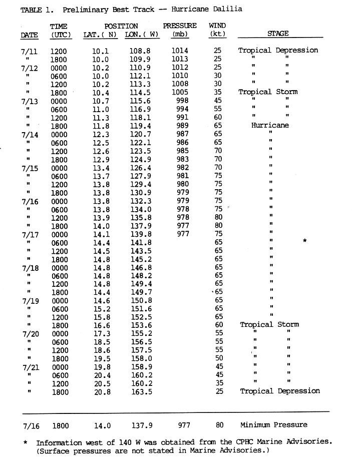
- ^ Jim Gross (1989-08-30). "Preliminary Report Hurricane Dalilia" (GIF). National Hurricane Center. p. 3. Retrieved 2006-01-04.
- ^ a b Andy Nash; Tim Craig; Sam Houston; Roy Matsuda; Jeff Powell; Ray Tanabe & Jim Weyman. "2006 Tropical Cyclones Central North Pacific". Central Pacific Hurricane Center. Retrieved 2008-09-14.
- ^ a b "The 1994 Central Pacific Tropical Cyclone Season". Central Pacific Hurricane Center. Retrieved 2008-09-14.
- ^ Re-analysis of the 1959 Manzanillo Mexico Hurricane (PDF) (Report). National Hurricane Center. 2016-02-04. Retrieved 2016-02-04.
- ^ a b Todd B. Kimberlain; Eric S. Blake; John P. Cangialosi (February 1, 2016). Hurricane Patricia (PDF) (Report). Tropical Cyclone Report. Miami, Florida: National Hurricane Center. Retrieved February 4, 2016.
- ^ Max Mayfield (1997-10-25). "Preliminary Report Hurricane Linda". National Hurricane Center. Retrieved 2006-01-04.
- ^ Chris D’Angelo (October 23, 2018). "Remote Hawaiian Island Wiped Off The Map". Huffington Post. Retrieved October 23, 2018.
- ^ Newsweek. Hurricane Lane Hawaii rainfall totals update: 'Extreme flooding impacts' continue from tropical storm (Report). Newsweek. Retrieved August 25, 2018.
- ^ Chris Landsea. "Subject: G8) Why do hurricanes hit the East coast of the U.S., but never the West coast?". FAQ: Hurricane, Typhoons, and Tropical Cyclones. Atlantic Oceanographic and Meteorological Laboratory Hurricane Research Division. Retrieved 2008-09-14.
- ^ Belles, Jonathan (August 3, 2018). "Hawaii Hurricanes: How Unusual Are They?". The Weather Channel. Archived from the original on August 20, 2018. Retrieved August 20, 2018.
- ^ John P. Cangialosi and Lixion A. Avila (December 3, 2009). "Hurricane Rick Tropical Cyclone Report" (PDF). National Hurricane Center. Retrieved December 14, 2009.
- ^ Brennan, Michael (April 2, 2019). Hurricane Willa (PDF) (Report). Tropical Cyclone Report. National Hurricane Center. Retrieved April 5, 2019.
- ^ Reinhart, Brad; Reinhart, Amanda (7 March 2024). "Hurricane Otis – Tropical Cyclone Report (EP182023)" (PDF). National Hurricane Center. University Park, Florida, United States: National Oceanic and Atmospheric Administration. pp. 1–39. Archived (PDF) from the original on 7 March 2024. Retrieved 7 March 2024.
| 1950s | |
|---|---|
| 1970s | |
| 1990s | |
| 2000s | |
| 2010s | |
| 2020s | |