
Muddy Branch Greenway Trail
| Muddy Branch Greenway Trail | |
|---|---|
 Muddy Branch Greenway Trail through a grassy forest | |
| Length | 9 miles (14 km) |
| Location | Montgomery County, Maryland |
| Trailheads | C&O Canal at Pennyfield Lock, Potomac Horse Center, Darnestown Road |
| Use | Hiking, Biking, equestrianism[1] |
| Surface | natural |
The Muddy Branch Greenway Trail is a 9 miles (14 km) long natural surface trail that runs from the Potomac River to Darnestown Road in Montgomery County, MD.[1] The trail runs near the course of Muddy Branch, a tributary stream of the Potomac River[2] that originates in Gaithersburg, Maryland.
The trail starts at Pennyfield Lock Road near the C&O Canal's Pennyfield Lock, Crosses Muddy Branch and runs through Blockhouse Point Conservation Park, across River Road and on to Esworthy Road. From there, the trail crosses the road and enters Muddy Branch Stream Valley Park and continues in the park until the end at Darnestown Road[2]
| Section | Name |
|---|---|
| Section 0 | Pennyfield Lock (Potomac River) to River Road |
| Section 1 | River Road to Esworthy Road |
| Section 2 | Esworthy Road to Turkeyfoot Road |
| Section 3 | Turkeyfoot Road to Quince Orchard Road |
| Section 4 | Quince Orchard Road to Maryland Route 28 |
- Different parts of the Muddy Branch Greenway Trail
-
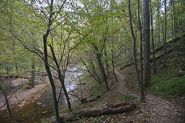 Muddy Branch Stream and Muddy Branch Trail
 -
 Muddy Branch Greenway Trail, Query Mill trailhead


References[edit]
- ^ a b "Muddy Branch Greenway Trail". Montgomery County Department of Parks. 2019-10-22. Retrieved 2020-10-08.
- ^ a b "Montgomery Park Trails". Montgomery County Department of Parks. Retrieved 2020-10-08.
- ^ "Maps -- Muddy Branch Alliance". Muddy Branch Alliance. Retrieved 2020-10-08.