Portal:Montana
The Montana PortalEast face of the Crazy Mountains in the northern Rocky Mountains of Montana (2015)
Montana (/mɒnˈtænə/ mon-TAN-ə) is a landlocked state in the Mountain West subregion of the Western United States. It borders Idaho to the west, North Dakota to the east, South Dakota to the southeast, Wyoming to the south, and the Canadian provinces of Alberta, British Columbia, and Saskatchewan to the north. It is the fourth-largest state by area, the eighth-least populous state, and the third-least densely populated state. Its capital is Helena, while the most populous city is Billings. The western half of the state contains numerous mountain ranges, while the eastern half is characterized by western prairie terrain and badlands, with smaller mountain ranges found throughout the state. Most of Montana first came under American sovereignty with the Louisiana Purchase in 1803 and was explored by the Lewis and Clark Expedition shortly thereafter. Fur trappers followed and were the main economic activity in the area until gold was discovered in 1852. The ensuing gold rush, along with the passage of the Homestead Acts in 1862, brought large numbers of American settlers to Montana. Rapid population growth and development culminated in statehood on November 8, 1889. Mining, particularly around Butte and Helena, would remain the state's main economic engine through the mid-20th century. Montana has no official nickname but several unofficial ones, most notably "Big Sky Country", "The Treasure State", "Land of the Shining Mountains", and "The Last Best Place". Its economy is primarily based on agriculture, including ranching and cereal grain farming. Other significant economic resources include oil, gas, coal, mining, and lumber. The health care, service, defense, and government sectors are also significant to the state's economy. Montana's fastest-growing sector is tourism, with 12.6 million tourists (as of 2019) visiting the state each year. (Full article...) Entries here consist of Good and Featured articles, which meet a core set of high editorial standards.
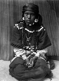
The Sip 'n Dip Lounge is a tiki bar in Great Falls, Montana, US, opened in 1962, when Polynesian themes were popular. It has survived to the present day with its tiki theme intact. Located inside a local motel that was considered modern and trendy at the time it was built, the Sip 'n Dip is known for having people dressed as mermaids swimming underwater in an indoor swimming pool visible through a window in the bar. Decorated with a bamboo ceiling and a South Seas theme, the bar featured "Piano Pat" Spoonheim, noted for her unique "jazzy" style, who played piano there from 1963 until her death in May 2021. The mermaid concept was introduced in 1995 when there was a revival of the tiki fad and was the brainchild of the bar's current owner who wanted to add a "fun factor". It became popular, particularly for Montana, a landlocked northern state where a tropical tiki theme is unexpected. Beginning in 2003, the bar began to gain prominence outside Montana, when the magazine GQ listed the lounge in its list of the top ten bars in the world, ranking it as the "#1 bar...worth flying for". The bar usually employs six women, who wear mermaid outfits designed and hand-made by the bar's manager, Sandra Johnson-Thares. Mermen were brought back in 2016, having previously appeared on occasion from the late 1990s to 2004. (Full article...)Selected article -The Pend d'Oreille or Pend d'Oreilles (/ˌpɒndəˈreɪ/ PON-də-RAY), also known as the Kalispel (/ˈkæləspɛl/), are Indigenous peoples of the Northwest Plateau. Today many of them live in Montana and eastern Washington of the United States. The Kalispel peoples referred to their primary tribal range as Kaniksu. Their traditional territory comprised the drainage systems of the Flathead River, Clark Fork, and Pend Oreille rivers. It extended from roughly present-day Plains, Montana, westward along the Clark Fork River, to Lake Pend Oreille and Priest Lake in Idaho, and the Pend Oreille River (Ntxwe, meaning "river") in eastern Washington and into British Columbia (Canada). (Full article...)General images -The following are images from various Montana-related articles on Wikipedia.
Did you know -
TopicsCategoriesNew articlesThis list was generated from these rules. Questions and feedback are always welcome! The search is being run daily with the most recent ~14 days of results. Note: Some articles may not be relevant to this project.
Rules | Match log | Results page (for watching) | Last updated: 2024-06-07 21:47 (UTC) Note: The list display can now be customized by each user. See List display personalization for details.
Related portalsWikiProjectsAssociated WikimediaThe following Wikimedia Foundation sister projects provide more on this subject:
Sources |


